This article is about how drones and paramotorism are revolutionizing plant exploration.
“Exploring plants from the sky isn’t just science—it’s a thrilling adventure that connects us to nature in bold new ways.” – The Economic Botanist
You might picture plant science as something that happens quietly in greenhouses or deep in forests, with scientists hunched over notebooks or microscopes. And sure, that happens. But there’s a whole other side to plant exploration that’s anything but quiet — it’s fast, bold, and happening from the sky.
Extreme botany is what happens when plant science meets adventure. Using drones and paramotors, researchers are now soaring over rainforests, cliffs, and wetlands to study plants in ways that just weren’t possible before. It’s not just cool tech — it’s changing the way we map ecosystems, track climate change, and protect rare species in hard-to-reach places.
This isn’t your typical fieldwork. This is high-flying, hands-on science that’s opening up wild new frontiers in the world of plants — and it might just be the future of conservation.
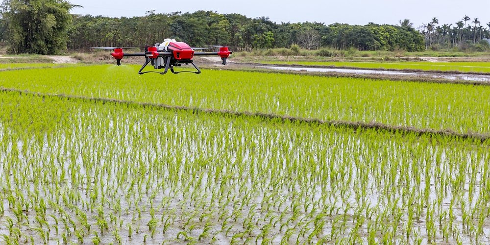
Drones in Plant Exploration
What are Drones in Botany?
Drones are remote-controlled or autonomous flying robots that carry cameras, sensors, and other gear. In plant science, they help researchers:
Map forests and grasslands
Measure plant health with multispectral cameras
Monitor endangered species
Gather data on growth patterns and biodiversity
Benefits of Using Drones
Speed & Access: You can cover remote or tough terrain fast. No more long hikes through jungles or mountains.
High-Resolution Data: Drones capture detailed images that let you assess plant health from the sky.
Cost-Effective: Compared to helicopters or manned aircraft, drones are way more affordable.
Safety: Researchers can avoid dangerous wildlife, rough terrain, and rough weather.
Types of DroneTech for Plants
Here are some common tools you’ll see in the world of drone plant research:
RGB Cameras — basic visuals for identifying plant communities.
Multispectral Sensors — detect plant stress or water content using wavelengths beyond visible light.
LiDAR — paints 3D maps of forest structure by bouncing lasers off trees.
Thermal Cameras — show water stress or fungal disease in plants by heat differences.
In many studies, combining these sensors gives a clearer picture. You know, like using both sight and X-ray vision to study plants!

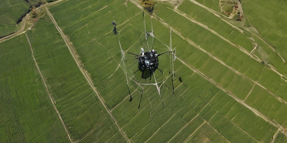
Paramotorism: Flying with Purpose
What is Paramotorism?
A paramotor (powered paraglider) is basically a backpack engine and a half-parachute. It lets you take off and glide, giving pilots great views and control. In plant science, it’s like hopping in a flying lab—quiet, flexible, and awesome for hanging out over forests or fields.
Why use a Paramotor?
Low-altitude Observation: Get close to the canopy or hover over rare plants.
Minimal Disturbance: The engines are quiet, and there’s nearly no footprint on the ground.
Flexibility: You can launch from small fields, fly low, circle around cool spots, or follow wildlife.
Platform for Gear: Mount cameras, sensors, or even sampling tools to collect plant material from above.
Paramotor Gear for Botanists
Lightweight cameras and sensors
GPS trackers for mapping
Sample collectors for leaf tissue or spores
Communication tools for real-time data collection
Why Extreme Botany Matters
Plant Conservation in High Definition
As our planet changes—thanks to climate shifts, invasive species, or disasters—we need fast, accurate data. Drones and paramotors give us that bird’s-eye view of endangered plant habitats, helping us act sooner.
Fun Fact
Drones can spot plants blooming beneath the snow! Using thermal imaging, researchers detected early spring blooms in alpine zones—before they peeked above snowbanks.
Speedy Scientific Discovery
Imagine discovering a new species because your drone spotted an odd plant in a remote ravine. That’s not sci‑fi—it’s now reality. Quick aerial surveys speed up the process from weeks or months to just days.
Connecting Humans to Plants
Because drones and paramotors let us see big green landscapes in action, they inspire wonder. They help us translate complex science into powerful images—like a forest canopy in multispectral color, showing healthy and stressed zones. That engages the public, policymakers, and fellow researchers.
How Drones and Paramotors Work Together
Matching Strengths
| Task | Drones | Paramotors |
|---|---|---|
| Aerial Mapping | Yes, efficient coverage | Yes, for smaller areas |
| Detailed Sampling | Limited (no landing) | Yes, can land or hover |
| Quick Deployment | Yes, ready to launch | Mostly yes, needs take-off scene |
| Low-altitude flexiblity | Moderate control | Excellent for tight areas |
| Payload Capacity | Light to medium (1-5 kg) | Medium to heavy with modifications |
Using both gives you full coverage: big-picture mapping from above and down-close exploration from below.
Coordinated Missions
Here’s how a combined mission might unfold:
Drone flight: scan 100 km² to find areas of interest (e.g., unusual plant health patterns).
Waypoint tagging: GPS coordinates mark those hot spots.
Paramotor launch: fly low, collect samples or detailed photos.
Data merge: combine high-res drone imagery with on-the-ground samples and paramotor video.
Analysis & action: research findings get plug-and-play for conservation planning or academic publishing.

Real-World Examples of Extreme Botany
Project – Rainforest Canopy Monitoring
In the Peruvian Amazon, researchers used drone fleets to scan tree canopy health and map carbon storage. Then paramotors carried lightweight LiDAR scanners for structure analysis. They spotted disease outbreaks early—before huge forest damage occurred.
Alpine Plant Survey
In the Swiss Alps, ecologists used paramotors to hover over cliffside meadows, snapping photos and collecting soil samples without risking human climbers.
Fun Fact
Paramotors have visited extinct plant sites! In remote islands, paramotor-led teams found seeds of plants thought extinct—hiding in cliff crevices unreachable by foot.
Coastal Wetland Restoration
Along the Gulf coast, drone imagery monitors marsh regrowth after hurricanes. Paramotors then collect seed capsules for restoration efforts—mixing big-picture surveys with sample collection in a single field day.
Challenges & Ethical Considerations
Legal & Regulatory Hurdles
Different countries have different drone and ultralight aircraft rules. You might need pilot licenses, flight permissions, and environmental permits. Always check local guidelines before taking off.
Safety Concerns
Risks include mechanical failures, sudden weather shifts, and wildlife disturbance. Stay sharp, carry redundant gear, and follow strict safety routines.
Data Management
All that imagery and sensor data adds up fast. You’ll need solid processes for storage, backup, and analysis—especially when analyzing multispectral or LiDAR datasets can involve terabytes of info.
Environmental Impact
Even quiet paramotors can disturb wildlife if flown too low. Be respectful, stay informed on habitats, and limit flights in sensitive areas—or avoid them during breeding seasons.
The Bottom Line
You—yes you—can join the thrilling new field of extreme botany. Drones and paramotorism are powerful tools for exploring, mapping, conserving, and researching the green world. With responsible planning, solid data practices, and ethical awareness, you can help uncover nature’s mysteries from two unique perspectives: high-tech drones and human-piloted paramotors.
This isn’t just science—it’s a friendly adventure that bridges gaps between technology, nature, and real-world impact. You’ll capture data, but also stories; you’ll publish papers, but also inspire broom-readers like us to care more about plants and the Earth we share.
********************
If you’re fired up by the idea of flying with purpose, start your extreme botany journey today:
Learn the basics: find drone pilot and paramotorist courses near you.
Connect with communities: look for local universities, citizen science groups, or conservation projects involved in plant research.
Start small: try a simple drone mapping project in a nearby park, or ride tandem with an experienced paramotor pilot.
Share your work: publish your images, findings, or stories online to inspire others—and attract collaborators.
Now go ahead—fly high, explore deep, and help our green world thrive!
Curious to see aerial datasets, need help picking your first drone, or want to link up with fellow botany explorers? Reach out—I’d love to help you start your own masterpiece of extreme botany!